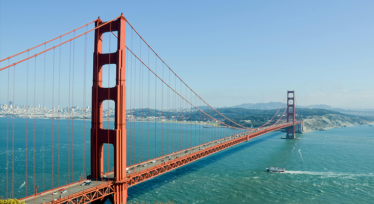
Few cities let you trade skyscrapers for sequoias or foghorns for alpine air in a single tank of gas. San Francisco is that kind of launch pad. Whether you’re a solo traveler chasing coastal sunsets, a digital nomad plotting a weekend reset, or an explorer collecting National Park stamps, this guide dives deep into the best road trips from San Francisco. You’ll find drive times, can’t-miss detours, budget hacks, eco-friendly pointers, and insider community tips everything you need to leave the Bay Bridge traffic behind and hit open road.
Why Road-Trip Out of San Francisco?
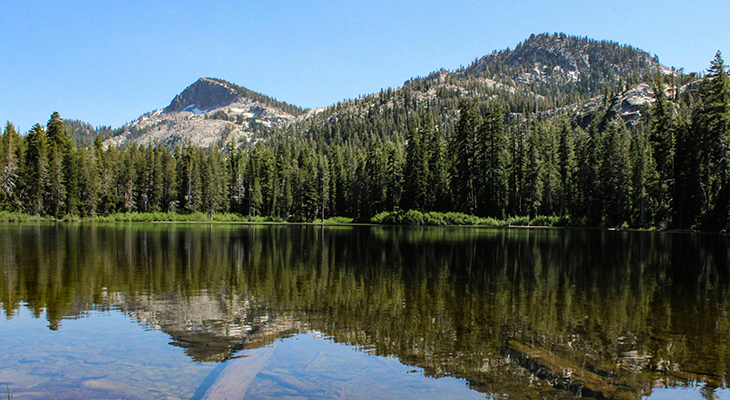
Within 300 miles of San Francisco you can kayak beneath granite cliffs, sip Zinfandel in century-old wine caves, and hike redwood groves bathed in Pacific mist. Driving yourself unlocks sunrise trailheads, roadside taco shacks, and the freedom to linger where tour buses never stop perfect for the flexible solo explorer.
-
Flex Scheduling: start at dawn for empty vistas or sleep in and chase sunsets.
-
Community on Your Terms: join hostel trivia or enjoy solo stargazing your call.
-
Cost Control: mix campouts with motels and skip overpriced package tours.
Quick Planning Checklist for Solo Travelers
-
Documents & Permits: National Park pass, Yosemite peak-season vehicle reservation, driver’s license/IDP.
-
Navigation Apps: download offline Google Maps; bookmark Caltrans QuickMap for road closures.
-
Safety Kit: mini compressor, jumper cables, 3-L water bladder, satellite messenger for Big Sur dead zones.
-
Budget Tools: GasBuddy for cheap fuel, Splitwise for cost-sharing with new convoy pals.
Best Time to Drive & Weather Insights
| Season | Coastal Routes | Mountain Routes | Solo Pro Tip |
|---|---|---|---|
| Spring | Wildflowers, marine fog | Snow melt, partial closures | Carry micro-spikes for Yosemite shoulder season hikes |
| Summer | Clear sunsets, big crowds | Prime hiking, booked lodges | Leave SF before 7 a.m. to beat Hwy-1 & I-80 traffic |
| Fall | Warm, fewer tourists | Aspens peak mid-Oct | Score shoulder-season motel deals in Tahoe |
| Winter | Storm-watching on Hwy 1 | Ski season, chain controls | Check Caltrans webcams + carry chains |
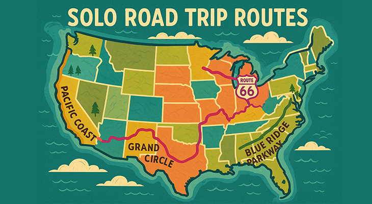
Top 10 Road Trips from San Francisco
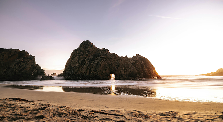
Pacific Coast Highway to Big Sur
Distance/Time: 146 mi • ≈2 h 30 m one-way
Mile Markers: Half Moon Bay → Bixby Creek Bridge → McWay Falls
Solo Insight: snag a bunk at Point Montara Lighthouse Hostel for instant travel-community
vibes.
Napa & Sonoma Wine Country Loop
Distance/Time: 120 mi round-trip • ≈2 h total drive
Don’t Miss: Carneros sunrise rows, Sonoma’s Fremont Diner, Calistoga mud baths
Budget Hack: volunteer for a 30-min vineyard dog-walk to waive tasting fees.
Lake Tahoe Alpine Escape
Distance/Time: 210 mi • ≈3 h 45 m via I-80
Highlights: Emerald Bay kayak, Heavenly gondola, Secret Cove swim.
Yosemite National Park Adventure
Distance/Time: 195 mi • 4–5 h via CA-120
Must-See: Glacier Point, Mist Trail, Tunnel View stars
Permit Alert: vehicle reservations May–Sept book early!
Point Reyes & Tomales Bay Coastal Ramble
Distance/Time: 37 mi • ≈1 h 10 m
Route Gems: Alamere Falls tidefall, elk at Tomales Point, Hog Island oysters
Solo Stay: hike-in Coast Camp = starry skies + campfire conversations.
Mendocino & Redwood Coast
Distance/Time: 186 mi • ≈3 h 30 m via US-101
Stops: Glass Beach, Avenue of the Giants, Fern Canyon
Budget Bed: $10 “hike-in” sites at state-park campgrounds.
Monterey & Carmel Scenic Circuit
Distance/Time: 120 mi • ≈2 h via US-101/CA-1
Highlights: 17-Mile Drive sea lions, Cannery Row bikes, Carmel fairy-tale cottages
Unique Angle: after-hours “Evening Tidepoolers” at Monterey Bay Aquarium great solo
meet-up.
Gold Country & Sierra Foothills
Distance/Time: 140 mi to Placerville; cruise CA-49
Must-Stops: Marshall Gold Discovery SP, Apple Hill pies, historic mines.
Lassen Volcanic & Shasta Lakes
Distance/Time: 240 mi • ≈4 h 30 m
Icons: Bumpass Hell hydrothermal area, Subway Cave lava tube
Remote-Work Hack: strong Wi-Fi at the Lassen visitor center.
Pinnacles National Park & Central Coast
Distance/Time: 125 mi • ≈2 h 15 m via US-101
Route: Gilroy garlic stop → High Peaks Trail → Hollister wineries
Only-Here Experience: volunteer condor-tracking hike with park biologists.
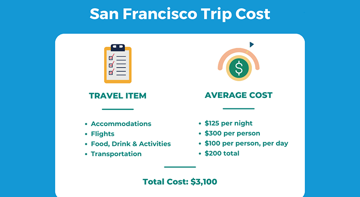
Budgeting & Logistics
| Expense | Coast (Hwy 1) | Mountains (Tahoe/Yosemite) | Money-Saver |
|---|---|---|---|
| Fuel (round-trip) | $60 | $90 | Drive ≤65 mph better mileage |
| Lodging | Hostel $30; Motel $75 | Campsite $15; Cabin $95 | Book weeknights for 20 % off |
| Food | Food-truck $8/day | Grocery cook-outs $12/day | Pack a camp stove |
EV & Car-Share: Turo rents Teslas from ~$65/day; fast chargers line Hwy 1 and I-80.
Parking Intel: Yosemite Valley lots fill by 9 a.m. arrive early or after 3 p.m.
Sustainable & Responsible Road-Tripping
-
Pack-in, pack-out even biodegradable food waste.
-
Choose hybrid/EV rentals California’s charger network grew 45 % in 2024.
-
Buy local: farm-stand strawberries over big-box snacks.
-
Stick to paved turnouts; coastal erosion repair costs millions.
-
Respect fire bans one spark ignited the 2020 CZU Complex.
Connecting with the Travel Community
Solo doesn’t mean solitary. Use apps like Couchsurfing “Hangouts,” Meetup’s outdoor groups, and Trespot’s city rooms to find hiking buddies or share gas money. Offer photography skills for surf lessons skill swaps flourish along the coast.
Quick Takeaways
-
Ten diverse routes: redwoods, wine, alpine lakes, volcanos.
-
Spring & fall shoulder seasons = cheaper, less crowded.
-
Solo-specific tips turn strangers into convoy friends.
-
Budget loops from ~$150 all-in for a weekend.
-
Eco-smart choices keep California stunning for decades.
FAQs Road Trips from San Francisco
What’s the best first-timer road trip from San Francisco?
The Monterey & Big Sur drive combines epic coastline with easy roads ideal for new road-trippers.
Can I do a Yosemite day trip and back?
Yes, but it’s 4 hours each way. Leave by 5 a.m. and plan limited hikes; staying one night is smoother.
Are EV chargers available along Highway 1?
Absolutely Half Moon Bay, Santa Cruz, Monterey, and select Big Sur lodges have Level-2 stations.
Is winter driving to Lake Tahoe safe?
Chains may be mandatory. Check Caltrans QuickMap and depart mid-week to avoid chain-check queues.
How far is Redwood National Park?
Roughly 325 miles (≈6 hours) north via US-101 best for a long-weekend loop.
Wrap-up
From tide-falls in Big Sur to volcanic basins in Lassen, these road trips from San Francisco turn a city break into a world-class adventure. Pick a route, screenshot the checklist, and share your departure in a travel forum future friends and unforgettable detours await just beyond the Golden Gate.
Our app is available for Android, iOS & Browser
Unlock authentic travel experiences by connecting with fellow travelers visiting city same time as you.
App is Live!
Meet travelers before you land
Trespot connects verified travelers already headed to your city. Chat in city groups, plan meetups, and ask for cheap local recommendations—before you even reach.
- 👋 Find travel buddies & real-time meetups
- 💬 Ask locals for budget tips & hidden gems
- ✅ Verified travelers only—zero spam
- 📍 City-specific chats for every trip